Revolutionary climate data portal critical to future planning
Knowledge of climate patterns is critically important for a variety of resource management issues, including groundwater and surface water development and protection, controlling and eradicating invasive species, protecting and restoring native ecosystems, and planning for the effects of global warming. Resource managers, climate researchers, educators and students have a powerful new tool with the launch of the Hawaiʻi Climate Data Portal (HCDP).

In support of closing data gaps and providing easy public access to climate data and information for the state, the University of Hawaiʻi’s Hawaiʻi Established Program to Stimulate Competitive Research (Hawaiʻi ESPCoR) ʻIke Wai project and the Hawaiʻi Data Science Institute have partnered with the UH Water Resources Research Center (WRRC) and East-West Center on this online open-source platform that hosts a wide range of data products, climate tools and resources.
“The Hawaiʻi Climate Data Portal provides streamlined access to high-quality reliable data and information that can be utilized by a range of stakeholders and be incorporated into near-real-time planning activities and management decisions,” said East-West Center Fellow and ʻIke Wai researcher Ryan Longman, who worked on the development of the portal with a team of about 20 from across UH and the community.
Demonstrating the portal’s power
After almost a decade of development, the HCDP launched on March 3, 2022, during a Hawaiʻi EPSCoR and Hawaiʻi Data Science Institute virtual event. Longman, WRRC director and ʻIke Wai project co-investigator Thomas Giambelluca, Sean Cleveland, lead software engineer from UH Information Technology Services, and a team of climate and data scientists who contributed to the development of the HCDP, demonstrated the data, tools and information available through the portal. These included the data visualization and download tool, Indigenous climate knowledge perspectives, and a variety of gridded climate products.

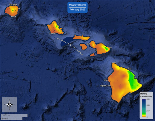
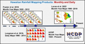
Climate data available through the portal include more than 100 years of monthly rainfall maps, 30 years of daily temperature maps and a range of other variables and products, most of which are updated in near-real-time. Other features of the HCDP include climate map visualization and download tools, a library of related journal publications and reports, climate research highlights, information on Indigenous knowledge and climate perspectives, and links to decision support tools and resources.
Fire risk, drought forecasting in the future
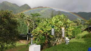
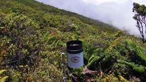
In the near future, the HCDP will host data from the Hawaiʻi Mesonet project which will deploy more than 90 climate stations statewide. Other features under development include near-real-time fire risk and early warning, drought forecasting and an avian malaria risk warning tool.

“Improving weather and climate monitoring in Hawaiʻi through the Hawaiʻi Mesonet and providing easy access to the data and data products through the HCDP will revolutionize Hawaiʻi-based research across a broad range of disciplines and provide much needed information to resource managers, emergency response agencies, decision makers and Hawaiʻi residents,” said Giambelluca.
Future features are being supported by the Hawaiʻi Emergency Management Agency and the National Oceanic and Atmospheric Administration.
More information on the HCDP and related UH research can be found on the EPSCoR Hawaiʻi website.
